Main  |  Sign In  |  Create Account

How do I use the Vehicle Location Map?
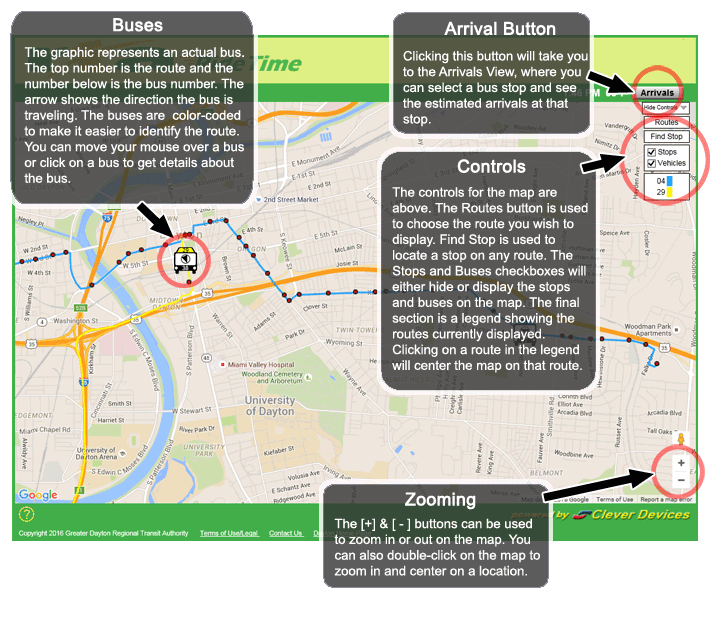
Zooming - The bar control can be used to zoom in or out on the map.  You can also double-click on the map to zoom in and center on a location. Buses - The graphic represents an actual Dayton bus.  The top number is the route and the number below is the bus number.  The arrow shows the direction the bus is traveling.  The buses are color-coded to make it easier to identify the route. You can move your mouse over a bus or click on a bus to get details about the bus. Bus Stops - The red dots represent bus stops on a bus route.  Red dots right next to each other represent bus stops on either side of the street, with buses going in opposite directions.  You can move your mouse over a stop or click on a stop to see the name of the stop and get details on when a bus is predicted to arrive at that stop. Controls - The controls for the map are above.  The Routes button is used to choose the route you wish to display.  Find Stop is used to locate a stop on any Dayton route.  The Stops and Buses checkboxes will either hide or display the stops and buses on the map.  The final section is a legend showing the routes currently displayed.  Clicking on a route in the legend will center the map on that route.

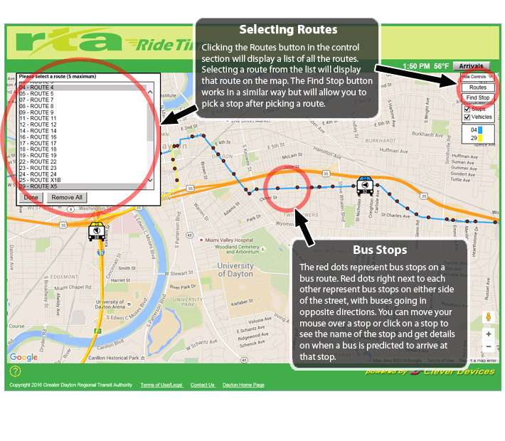
Selecting Routes - Clicking the Routes button in the control section will display a list of all the Dayton routes.  Selecting a route from the list will display that route on the map.  The Find Stop button works in a similar way but will allow you to pick a stop after picking a route.

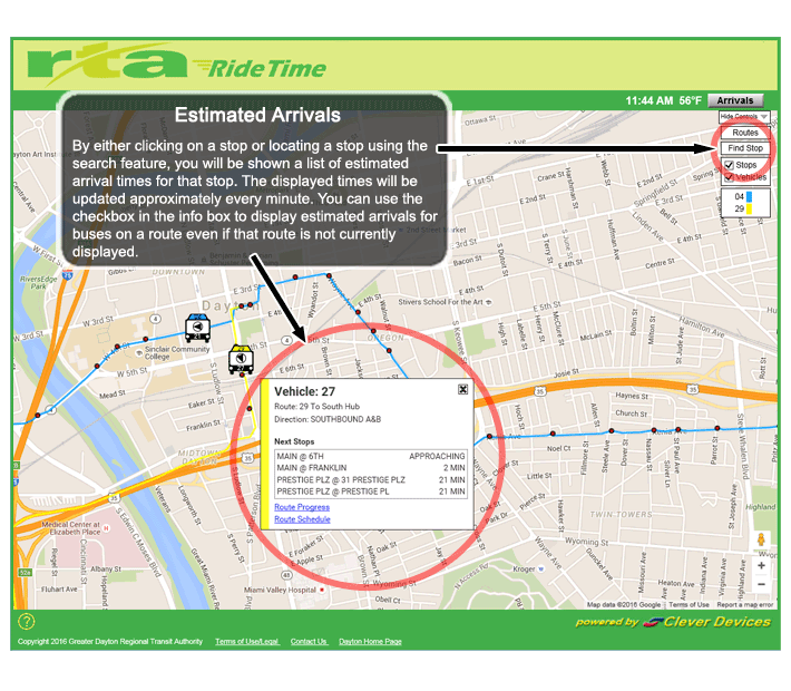
Estimated Arrivals - By either clicking on a stop or locating a stop using the search feature, you will be shown a list of estimated arrival times for that stop.  The displayed times will be updated approximately every minute. You can use the checkbox in the info box to display estimated arrivals for buses on a route even if that route is not currently displayed.

Bus Information - You can view information about any bus on the map including the final destination and the next few stops by clicking on the bus. Special Links - The Route Progress link will display a special view showing all buses with the same final destination as this bus.  You can also use that view to receive a pop-up notification when a bus has reached a selected stop. The Route Schedule link will display the Dayton schedule for the selected bus line.

For the Route Progress View
Clicking on a vehicle will bring up a box that allows you to click on a link for Route Progress. You can also set an alarm to receive a pop-up notification on your computer when a vehicle has reached a selected stop. Click here to learn more about the Route Progress View.

Home  Show Me the Vehicle Location Map